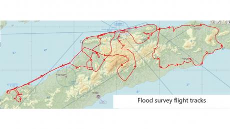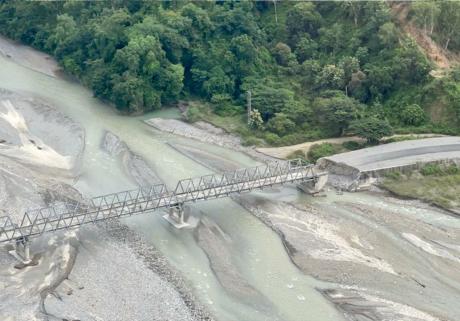
MAF organised an aerial survey for numerous organisations to assess the damage caused by severe flooding across Timor-Leste.
In early April 2021, Timor-Leste experienced torrential rains and flash flooding in various parts of the country. In the capital city of Dili, the flooding was the worst they had experienced in 40 years.
The vast devastation caused by the flooding claimed many lives, homes and livelihoods; landslides added to the destruction; infrastructure and agricultural land in different parts of the country were also damaged.

The flights provided by Mission Aviation Fellowship have enabled WFP and the Government to assess damages within days instead of weeks
With roads and bridges washed away during the flood, some communities were inaccessible by road. MAF organised an aerial survey for numerous organisations to assess the damage caused by severe flooding. Onboard our aircraft were teams from the World Food Program (WFP), the Ministry of Public Works, the Ministry of Agriculture, SSGC, DCP and FAO. It really was a joint effort, with different organisations coming together to figure out the best way to reach and help those affected by the floods.
"The flights provided by Mission Aviation Fellowship have enabled WFP and the Government to assess damages within days instead of weeks if we were to do it the old way," shared Dageng Liu, WFP Timor-Leste Country Director. "I am pleased to see the partnership has made a positive contribution towards the country’s recovery from the devastating floods,” he added.
Read the full WPF Media release here: https://www.wfp.org/news/aerial-assessments-help-timor-leste- recover-following-worst-floods-40-years
Story: Lungpinglak Domtta